Category:Dams to Darnley Country Park
Jump to navigation
Jump to search
country park to the south-west of Glasgow, Scotland, UK  | |||||
| Upload media | |||||
| Instance of | |||||
|---|---|---|---|---|---|
| Location | East Renfrewshire, Scotland | ||||
| Operator | |||||
| official website | |||||
 | |||||
Dams to Darnley Country Park in Scotland is located between the southern periphery of Glasgow and the town of Barrhead.
Subcategories
This category has the following 4 subcategories, out of 4 total.
Media in category "Dams to Darnley Country Park"
The following 16 files are in this category, out of 16 total.
-
 Brock Burn - geograph.org.uk - 156725.jpg 640 × 480; 158 KB
-
 Brock Burn - geograph.org.uk - 156732.jpg 640 × 480; 217 KB
-
 Brock Burn from Nitshill Road - geograph.org.uk - 1319169.jpg 640 × 480; 198 KB
-
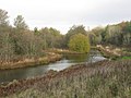
 Brock Burn near Darnley Mill (geograph 4852787).jpg 1,600 × 1,200; 557 KB
-
 Dams to Darnley Country Park SUDS pond (geograph 4643322).jpg 1,847 × 1,454; 781 KB
-
 Darnley Mill Country Park (geograph 3740441).jpg 640 × 480; 84 KB
-
 Entrance to Dams to Darnley Country Park (geograph 4943485).jpg 3,504 × 2,336; 3.35 MB
-
 New paths (geograph 4852777).jpg 1,600 × 1,200; 514 KB
-
 Old Direction sign - Signpost (geograph 6071970).jpg 640 × 480; 232 KB
-
 Path round Balgray Reservoir (geograph 4943515).jpg 3,354 × 2,207; 2.52 MB
-
 Path, Balgray Reservoir (geograph 5098984).jpg 800 × 600; 208 KB
-
 Paths at Darnley Mill (geograph 5982042).jpg 1,600 × 1,111; 562 KB
-
 Ruin, Waulkmill Glen (geograph 5098710).jpg 800 × 600; 325 KB
-
 Steps into Darnley Mill Country Park - geograph.org.uk - 1319162.jpg 640 × 480; 186 KB
-
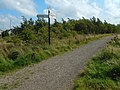 The start of a footpath (geograph 6264268).jpg 1,024 × 768; 259 KB
-
 Weir on the Brock Burn (geograph 3740457).jpg 640 × 480; 143 KB


.jpg)
.jpg)
.jpg)
.jpg)
.jpg)
.jpg)
.jpg)
.jpg)
.jpg)
.jpg)

.jpg)
.jpg)